 geo.be Metadata Catalog
Belgian part of the North Sea
Type of resources
Topics
INSPIRE themes
Keywords
Contact for the resource
Provided by
Years
Formats
Representation types
-

The dataset contains the borders of the Belgian marine waters in the North Sea and the different geographical areas (‘reporting units’) used when reporting in the frame of the the Marine Strategy Framework Directive 2008/56/EC (MSFD) and the Water Framework directive 2000/60/EC (WFD). The ecological status in the frame of WFD is reported for the coastal waters, defined as the one-nautical mile area, while the chemical status needs to be reported for the territorial waters (up to 12 nautical miles). MSFD requires information for the whole area, encompassing the territorial waters and the Belgian Exclusive Economic Zone. For some descriptors, results have been reported separately for the WFD subdivisions during the update of the initial assessment in 2018.
-
This dataset describes the extents and location of Reefs in the Belgian Part of the North Sea (BPNS) as required for article 17 of the Council Directive 92/43/EEC of 21 May 1992 on the conservation of natural habitats and of wild fauna and flora. The Council Directive seeks to contribute to ensuring biodiversity in the European Union by the conservation of natural habitats and wild fauna and flora species.
-
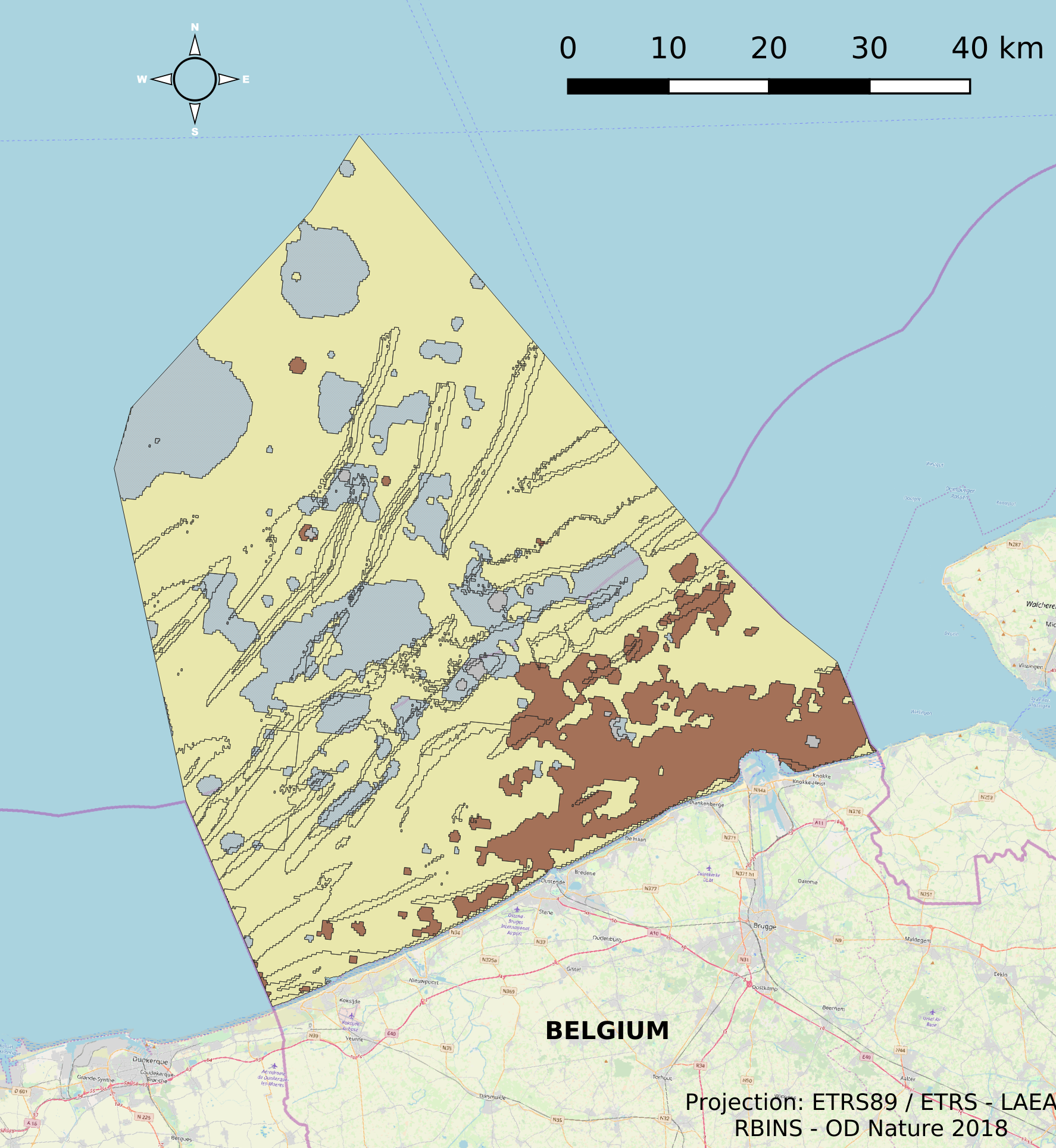
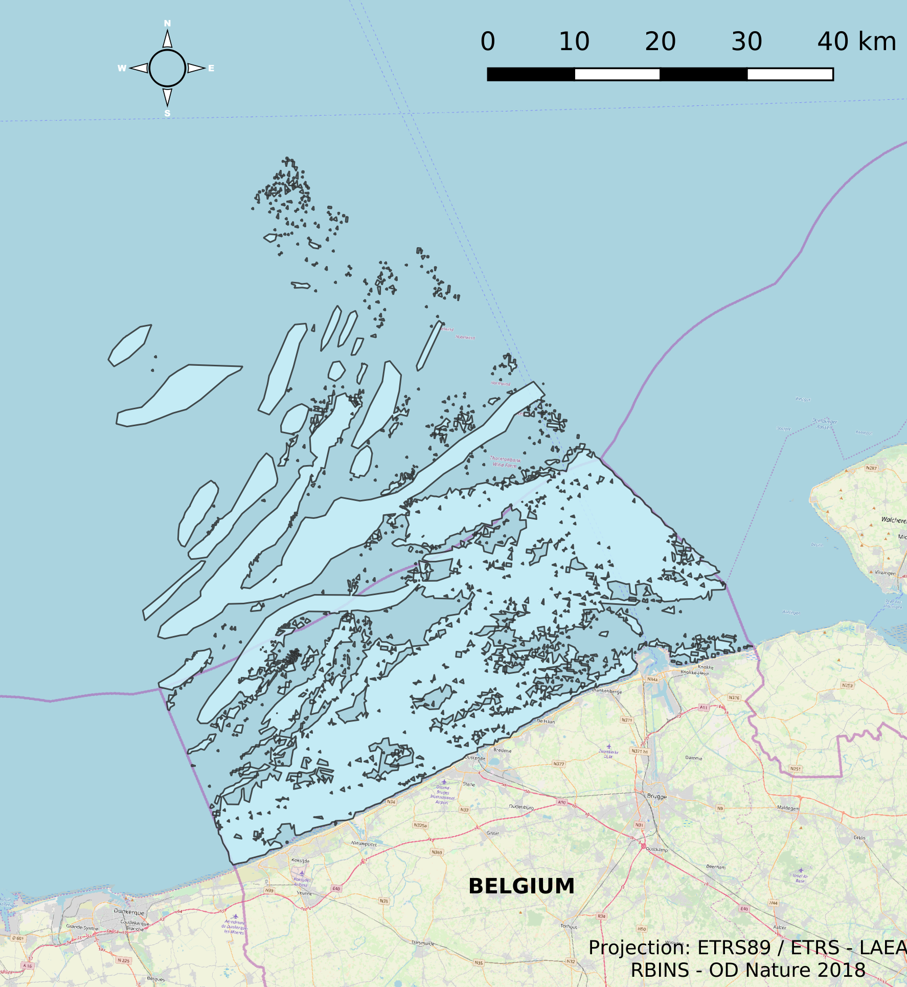
The dataset describes the physical habitats in the Belgian Part of the North Sea. It uses the EUNIS classification system as well as the MSFD Habitat codelist for the description and classification of the BPNS. It provides also information on the energy, biozone and type of substrate for the different areas in the BPNS.
-

This dataset represents the exact location of disused telecommunication cables installed in the Belgian Part of the North Sea.
-

This dataset is part of the 2018 Belgian submission for the Marine Strategy Framework Directive (MSFD) linked to descriptor 8, criterion 4. This dataset contains measurements on the 7-Ethoxyresorufin-O-deethylase (EROD) activity in Limanda limanda, Imposex (OTIN in Mytilus edulis), fish diseases and counts of oiled common guillemots in the Belgian part of the North Sea.
-
This dataset is part of the Belgian submission for the 2018 Marine Strategic Framework Directive (MSFD) and reports on descriptor 1, criterion 6. This dataset describes the soft benthos analysis performed in the Belgian part of the North Sea between 2010 and 2016. Information on the location, date and procedure used for the sediment sampling is povided as well as the description of the species found in the samples. Based on this dataset, the Belgian MSFD reporting concluded that the benthic habitat quality is clearly lower in areas where a certain activity interferes with the environment in an intensive way.
-
This dataset is part of the 2018 Belgian submission for the Marine Strategy Framework Directive (MSFD) linked to descriptor 6, criterion 5. It comprises three datasets used to assess the sea floor integrity for ensuring a proper functioning of the ecosystem.The dataset on the study of the fauna associated with cobble fields (hard substrates) describes the gravel analysis performed in the Belgian part of the North Sea between 2015 and 2017. Information on the location, date and procedure used for the sediment sampling is provided as well as the description of species found in the samples.The occurrence of important benthic species. The status of benthic habitats (soft substrates).
-

The Royal Decree of 22 May 2019 establishing a marine spatial plan defines 1 coastal protection experiments zone: Zone for coastal protection experiments (Art. 16§2). It replaces the 2014 Marine Spatial Plan, which is included for completeness. The Royal Decree of 20 March 2014 establishing a marine spatial plan defines in its Art. 12. §1 one zone for coastal protection experiments. This zone is made available digitally in the resource described by this metadata document. Please refer to the Belgian official gazette (\"Moniteur belge/Belgisch Staatsblad\") for official reference information.
-

The Royal Decree of 22 May 2019 establishing a marine spatial plan defines 6 energy, cable and pipeline zones: Area 1 for renewable energy (Eastern zone) (Art. 8§1), Area 2 for renewable energy (Noordhinder North) (Art. 8§2), Area 3 for renewable energy (Noordhinder Zuid) (Art. 8§3), Area for renewable energy - zone 4 (Fairybank) (Art. 8§3), Modular offshore grid for transmission of energy (Art. 8§5), Pipelines and cables corridor (Art. 9§1). It replaces the 2014 Marine Spatial Plan, which is included for completeness. The Royal Decree of 20 March 2014 establishing a marine spatial plan defines in its Art. 9. five dredged material disposal sites (Dredged material disposal site S1, Art. 9 § 6.1°; Dredged material disposal site S2, Art. 9 § 6.2°; Dredged material disposal site Bruggen en Wegen Oostende, Art. 9 § 6.3°; Dredged material disposal site Bruggen en Wegen Zeebrugge Oost, Art. 9 § 6.4°; Dredged material disposal site Bruggen en Wegen Nieuwpoort, Art. 9 § 6.5°). These zones are made available digitally in the resource described by this metadata document. Please refer to the Belgian official gazette (\"Moniteur belge/Belgisch Staatsblad\") for official reference information.
-
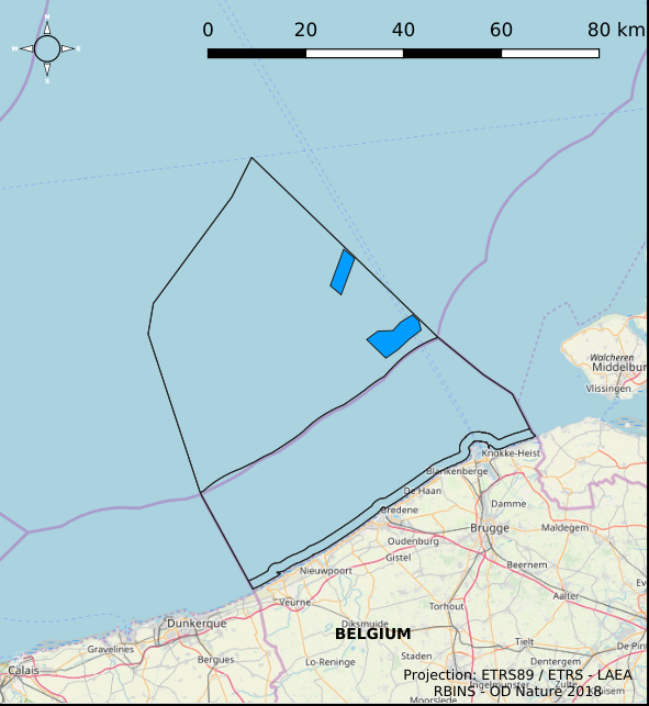
The Royal Decree of 22 May 2019 establishing a marine spatial plan defines 4 aquaculture zones: Zone 1 for aquaculture (Eastern zone) (Art. 14§1), Zone 2 for aquaculture (Noordhinder Noord) (Art. 14§2), Zone 3 for aquaculture (Noordhinder Zuid) (Art. 14§3), Zone 4 for aquaculture (Fairybank) (Art. 14§3). It replaces the 2014 Marine Spatial Plan, which is included for completeness. The Royal Decree of 20 March 2014 establishing a marine spatial plan defines in its Art. 10, two zones for sustainable aquaculture: Zone 1 for sustainable aquaculture, Art. 10 § 2 Zone 1; Zone 2 for sustainable aquaculture, Art. 10 § 2 Zone 2. These zones are made available digitally in the resource described by this metadata document. Please refer to the Belgian official gazette (\"Moniteur belge/Belgisch Staatsblad\") for official reference information.